King County launches study on Snoqualmie River levee and more
Published 1:30 am Wednesday, May 5, 2021


King County will be conducting a study this year to identify levees across the county that could be at risk of breaching, including the South Fork Snoqualmie.
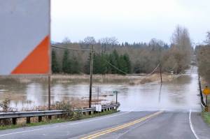
If levees were to break, communities along these rivers could be at risk. The rivers to be surveyed include the lower Raging River, the lower Tolt River, the South Fork Snoqualmie River, the South Fork Skykomish and the lower Cedar River. Recommendations on potential repairs and improvements will be made following the survey.
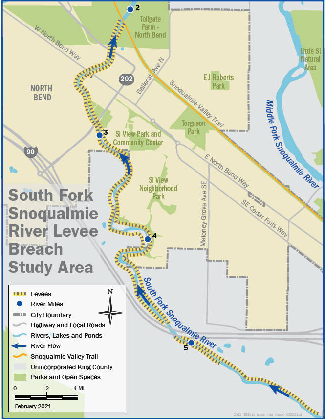
The levee system along the South Fork Snoqualmie consists of 11 levees, for a total of 6.25 miles, that are adjacent to the river as it runs through North Bend and the surrounding areas. The study will be conducted from May to August and findings will be shared in a report next March. It is being sponsored by the King County Flood Control District.
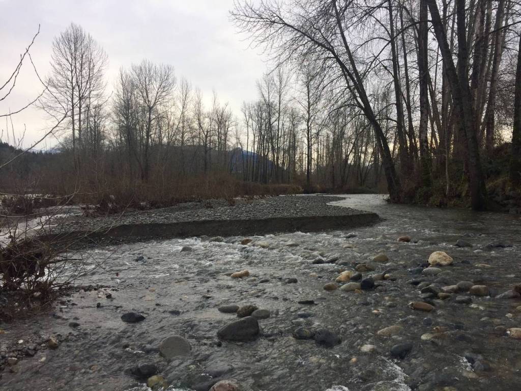
Flooding along rivers is a natural process where floodwaters spread across a river’s flood plain. To reduce the frequency and extent of flooding, levees were built to contain them. Historically, many levees were built to protect farmland and small communities from frequent flooding. The typical construction method for these in the early 20th century was to dig up sand and gravel from the riverbed and place it on the riverbanks to create a levee. Levees constructed this way can be porous and susceptible to water seepage and bank erosion.
To fix this, levees built today use engineered materials like fine-grain fill as well as surface erosion protection. Even still, modern levees can still breach and put people and properties at risk.
A 2019 study inventoried levees across King County, including along the Snoqualmie River. It found no levee breach modeling had been conducted on the stretch of river near North Bend. Levees along the river were constructed with sand and gravel and have moderate to high permeability. These levees also range in height from 2 to 10 feet, and in most areas are less than 5 feet.
Levees along the river were raised and strengthened by the county in the 1960s to handle 50-year floods. However, the levees don’t function as well as they should, and the right banks of the river are higher than the left banks by design. These levees are not accredited by FEMA as flood control levees.
During a 100-year flood event, it’s estimated that 222 properties and 5.5 miles of roadway are at risk. If floodwaters were to top the higher right banks of the river, the report states that the North Bend Wastewater Treatment Plant could be at risk.