If the Tolt River Dam breaks, these places are at risk of flooding
Published 5:00 pm Tuesday, May 18, 2021


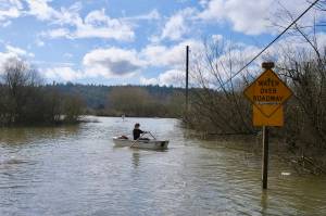
Ever since a false dam failure alarm sent Carnation residents scrambling for higher ground last July, city officials and residents have been asking Seattle Public Utilities for inundation maps.
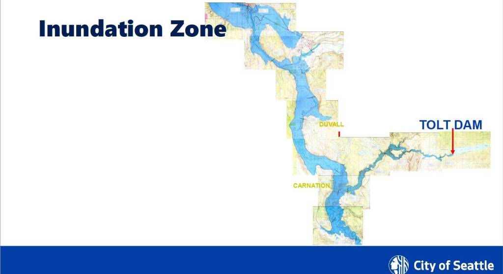
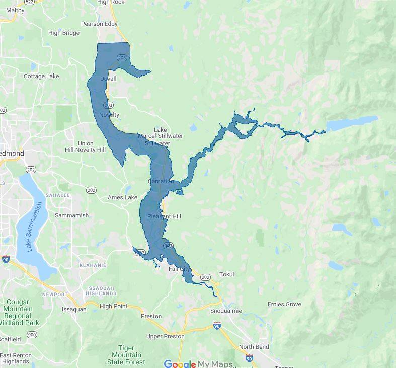
These maps show areas where water from the Tolt River dam would flood if the dam were to fail. This week, the King County Office of Emergency Management released a Google map showing a rough outline of areas that would be flooded, stretching from King County’s northern border down through Fall City. The dam itself is owned and operated by Seattle Public Utilities, and the utility company works with the county to create and implement emergency response plans.
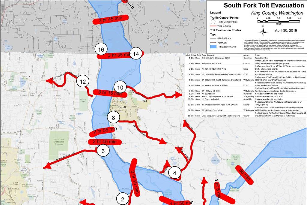
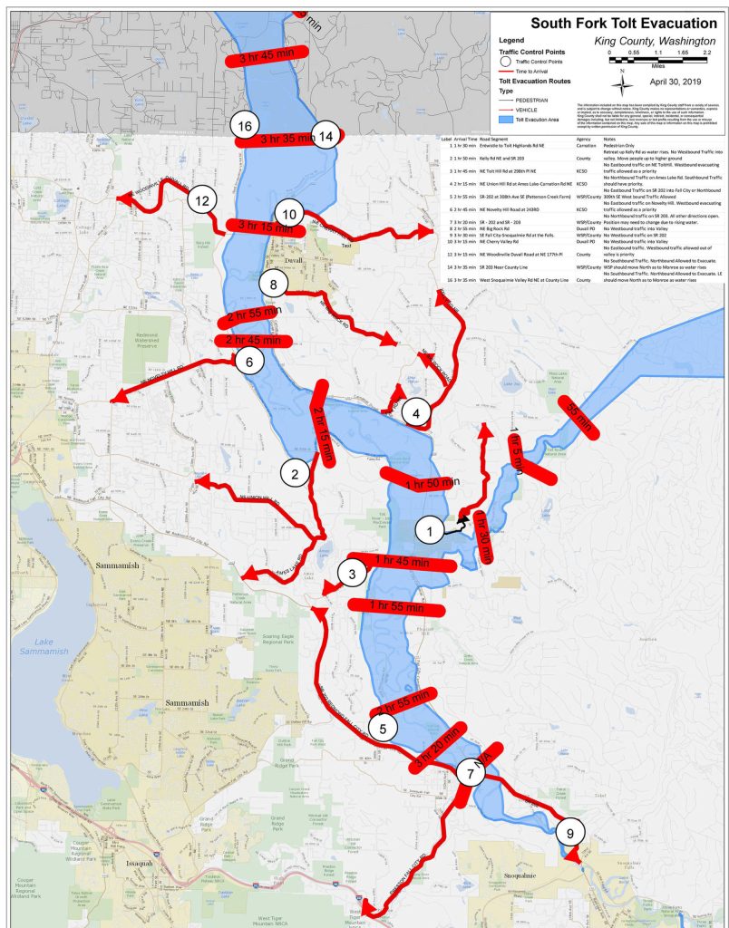
Through a records request filed with Seattle Public Utilities, this newspaper obtained two, more detailed maps, one of which is dated from April 2019, and can be seen at the top of this story. It shows when flood waters are expected to reach various communities throughout the Snoqualmie Valley.
The map shows that flood waters would reach Carnation within an hour and a half, and spread south to Fall city in three hours and 20 minutes. To the north, it would reach Duvall within three hours, and continue further into Snohomish County. The second map, also discovered in the records request, shows inundation stretching deep into Snohomish County.
Alex Chen, Seattle Public Utilities interim branch deputy director for drinking water, said they weren’t planning on releasing the map which shows estimated flood water arrival times. Chen said they’re concerned that such maps could give a false sense of security to residents, who if the dam failed, may believe they have a set amount of time left before they should evacuate.
Chen stressed that the maps, and flood times, were only estimates using a number of assumptions about what a worst-case scenario may look like, and could vary significantly depending on a variety of factors.
“We don’t want people to be relying on these estimated times to guide their response,” he said.
Instead, both Seattle Public Utilities and King County’s emergency management hope people who receive alerts in the event of a dam failure will evacuate immediately.
Chad Buechler, emergency management program leader with Seattle Public Utilities, said the message he wanted to convey was in the event of an emergency, grab loved ones, pets and a go-bag, and get out immediately.
Carnation officials and Seattle Public Utilities said there are no concerns over the safety of the dam itself. The dam is monitored around the clock and receives daily inspections, and remains in compliance with federal regulations.
For the Google map released by King County, a description states that the city of Seattle “cannot guarantee the accuracy of the information contained in this map. Each user of this map is responsible for determining its suitability for their intended use or purpose.”
“In the event of an actual failure, the affected areas will depend on specific failure conditions and will likely differ from mapping shown,” the statement continues.
The county released the Google map after Carnation officials and residents consistently requested them, said Carnation Mayor Kim Lisk.
“That was one of our big pushes,” Lisk said.
The records request filed by this newspaper shows that since at least July 2020, residents were asking for more information on inundation. One person requested “simple info that would let the residents know the danger zones.”
In response, a civil engineer with Seattle Public Utilities wrote that the inundation route had been modeled as part of the Tolt Emergency Action Plan, but that these maps “contain references to critical infrastructure and are not typically released to the public.”
But during an actual dam failure, people in the inundation zone need to know whether they’re at risk, and where to evacuate to, Lisk said.
For people outside of the inundation zone, the best thing to do is to stay put and not add to traffic, Lisk said. But without detailed maps, it can be difficult for people to know whether they should stay or go.
“To me, it’s like the more information, the better prepared you can be in an emergency,” Lisk said.
Since July, Lisk said Seattle Public Utilities has been working more closely with the city and community, following the false alarm. Seattle Public Utilities stated in previous coverage that they are designing upgrades to the siren system.
This includes ordering replacement sirens, starting design work and getting the necessary permits. They hope to get the needed federal permits by the end of this year, and the sirens should be installed in the first half of 2022.
The alarm system failed to activate during regular weekly tests last year, and sent out a false alarm last July.