Officials eye up Falls Crossing’s viewshed issues
Published 3:19 pm Thursday, October 2, 2008
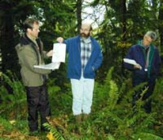
SNOQUALMIE — They said the panoramic views from
Snoqualmie Falls would not be impacted. They claimed that there was enough
vegetation on the hills to hide their proposed development. And last weekend,
officials from Puget Western Inc. (PWI) invited a group of city
representatives and community members to envision the scene for themselves.
Opponents of the development, however, said the development
would compromise the structure-free view from the Falls. But, said the
city’s viewshed consultant, Roger Dane, with a little tweaking and
planning, that won’t be the case.
“The majority of the site will be screened by existing
[vegetation],” Dane said of the view from the
Falls. “There might be some peek-a-boo views … we asked for
additional viewshed buffers on the top of the slope and areas not screened.”
Dane proposed that PWI include an additional 150 feet of buffer
along the northern edge of the Falls Crossing Development. The consultant
also requested that no construction be done until the new growth has time to
mature, which could take as long as five to 10 years.
“Some would (provide adequate screening) as soon as installed. It
depends on the quality and size of plant material they can get
established,” Dane said. “It is difficult to say
how long it would take.”
Bob Boyd, president of PWI, said the additional buffer wouldn’t be
a problem to include in the plans, but it would probably be more like 125 feet.
“Protection of the views have always been important to us, and
we want to protect and preserve the area and its natural condition,” he
commented.
Another concern expressed by commission members was if
visitors at the Falls would be able to see lights shining from the 370-home
development.
“You wouldn’t be able to see lights directly,” Dane said. “But
that wouldn’t say you wouldn’t see an indirect glow.”
PWI’s consultant Tom Berger took a less conservative approach to
the situation.
“The height of the houses are 35 feet with vegetation 40-to
50-feet high, you won’t be able to see anything — not enough mass of light
to see a glow,” he said.
Not everyone at the gathering, however, was convinced that
additional trees and shrubs would be the cure-all for the situation.
“They’re talking about adding artificial vegetation, and in some
cases new vegetation. But with winds, you can’t guarantee that this
vegetation will stay standing. It’s natural for
trees to fall all the time,” said Catherine Bunn of Snoqualmie.
“And Snoqualmie Falls is very popular, and we owe it to our
visitors to be able to be in nature with the sacredness of the Falls,” she added.
Instead of using the land for housing, retail and commercial areas,
Bunn said she would rather see the property converted into an interpretive
center featuring Native American history and artifacts.
But it is highly unlikely that PWI will back out of its plans for
developing the property along State Route 202 below Snoqualmie Ridge. PWI
President Bob Boyd said his company has been considerate of the
community and that the natural areas around the development will be attractive
for many.
“We carefully listened to the people in the Valley for seven to
eight years, and we feel we have done an effective job,” he said. “Leaving
50 percent of the site in its natural state is a very significant action that
protects the rural character of Snoqualmie and the Upper Valley.
“We feel we have been good stewards of the property,” Boyd added.
The members of the planning commission refrained from discussing
the project until the public comment period ended on Nov. 10, after the
Valley Record went to press. The commission was scheduled to meet on
the same night to begin deliberations. The planning board will eventually
forward their recommendation to the city council.
“We want careful and considerate deliberation,” said commission
chairman Matthew Stone.
Regarding Saturday’s five-hour tour, Stone said it was helpful to
be able to view the property for himself, adding, “It’s always good to
actually see things. Paper maps just don’t cut it.”