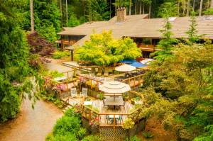
Welcome to a hiker’s paradise
Published 11:28 pm Thursday, October 2, 2008
Whether you’re looking for an easy stroll along a stream, a
strenuous climb atop a peak, or days of backpacking pleasure among lakes
and mountains, you’ll find it in the Snoqualmie Valley.
The choices are as close as Mount Si, towering over the Valley and
providing enjoyment and challenges for children and adults. Most hikes
begin just off Interstate 90.
The John Wayne Pioneer Trail in Iron Horse State Park, off of Exit
32, is a relatively flat trail that runs 270 miles from Cedar Falls to Idaho.
The trail is open mainly for hiking and bicycling in the summer and
cross-country skiing in the winter. Horseback riding is also allowed in
certain areas. Earlier this year, the damaged Hall Creek Train Trestle was
replaced, allowing uninterrupted access farther east. The John Wayne Trail
snakes through five state parks including Olallie State Park and Lake
Easton State Park and the 2.3 mile Snoqualmie Tunnel, which
reopened in 1994. Carrying a flashlight and extra clothes is recommended if you
plan to go through the tunnel because it’s cold, dark and wet.
The most popular excursion, however, is Mount Si with its rugged
steep cliffs overlooking North Bend. It’s not for the weak of heart, however,
since it ascends 3,100 feet in less than four miles.
Nearly 50,000 people a year climb the 4,167-foot peak, part of the
Mount Si Natural Resources Conservation Area.
The rewards come at the top. On a clear day, a hiker can see
the Snoqualmie Valley, Mount Rainier, Lake Washington, Seattle,
Puget Sound and the Olympic Range.
Be warned, though, that the scramble up Haystack Rock can
be dangerous to climbers as well as to those below who must dodge
dislodged rocks.
Three other trails are managed by the state, as well.
Little Si — the cone-shaped peak at the bottom of Big Si — is
criss-crossed by trails and includes a challenging area for rock climbers.
Rattlesnake Ledge is a short trail with nice views from the top of
the ledge, located at the southern end of Rattlesnake Mountain Scenic
Area. Glimpse views of the Upper Valley, Rattlesnake Lake and Chester
Morse Lake (which supplies two-thirds of Seattle’s drinking water) from
the ledge.
But the best choice, especially for people seeking scenery without
much sweat, is at Twin Falls. Catwalks and bridges provide a safe and easy
way to view the pretty falls along the South Fork-Snoqualmie River.
You can get to the falls either by the low road (off 468th Street, a
nearly level hike) or from above (at Exit 38 on I-90.) With two cars, hikers
can start at one end and finish at the other.
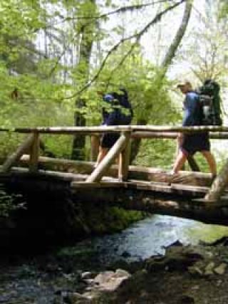
Farther away from town are numerous trails managed through
the North Bend Ranger District, including those in the Alpine Lakes
Wilderness.
The ranger station, (425) 888-1421, is just east of North Bend
at 42404 North Bend Way and provides updated trail conditions, maps and
advice.
Hikers can also purchase mandatory trail head parking permits
there for $25 (annual pass) or $3 (day pass).
The parking permit program began several years ago to raise
money for trail maintenance. Permits can be used in most national forests in
Washington and Oregon.
One of the most popular hikes is to Snow Lake. Starting at
the Alpental Ski Area parking lot (near Snoqualmie Pass), it’s a steady
three miles uphill to the ridge above pretty Snow Lake.
If it’s crowded, continue around to the far side for nice spots to
eat lunch in peace with great views of the talus slopes surrounding the
lake. Gem Lake is another two miles, or you can drop down the outlet stream
and follow Rock Creek to the Middle Fork trail, six miles away.
Here are two more easy hikes.
You can get to Talapus or Olallie lakes, about a four-mile round-trip,
on a well-groomed forest trail. Or hike up Denny Creek to Keekwulee
Falls, three miles round-trip.
Want more? Snowshoe Falls is another half-mile away. Keep
going and you’ll reach the outlet at Melakwa Lake, 4.5 miles from the start.
To make a loop, head three more miles to Pratt Lake (passing
Lower Tuscohatchie Lake) along the way.
From Pratt Lake, it’s six miles to the trailhead and another five
miles to the Denny Creek Trailhead.