
The City of Snoqualmie is nearing the completion of a stabilization project along the Snoqualmie River that is designed to protect critical infrastructure from increasing erosion.
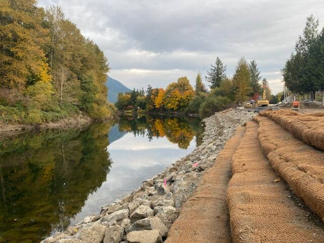
The project involves placing a revetment — a sloped barricade made of 400 feet of wood and rocks meant to stabilize the river bank — at the downtown intersection of Park Avenue and River Street.
The revetment saves both the road adjacent to the river and an underground waterline that connects the city to Canyon Springs, one its three primary drinking water sources.
Jeff Hamlin, the city’s interim operations manager, said that without the revetment, there were concerns that the road, water line and additional storm drainage infrastructure could have been crumbled and lost to erosion.
“It was absolutely critical that we stabilized the revetment at this location,” he said. “We were having to continually fight losing the road and [Canyon Springs] is our most critical water line.”
The new revetment project comes after a 2015 post-flood inspection, which found two sections of an existing revetment had been damaged, and a 2017 effort to fix the Canyon Springs water line.
With the new embankment, Park Avenue SE becomes a one-lane road, with a sidewalk that extends all the way to the intersection of River Street and Falls Avenue. Hamlin said so far this change has not caused issues and has reduced the volume of traffic down the road.
The project also includes the removal of invasive plants along the river and the planting of 1,800 native trees and shrubs, some of which will become full grown trees.
The project was a collaboration between the city and county’s Flood Control District, which is paying 90% of the project’s $3.6 million cost, Hamlin said. The county has orchestrated a series of similar projects along the Snoqualmie River amid increasing erosion of the river’s bank.
Erosion increased after a 2014 construction project, when a weir (a type of dam) at the Snoqualmie Falls power plant was lowered to allow for water levels to reach the plant’s intake and turbine and reduce flooding above the falls.
“What that did was help our downtown with flooding,” Hamlin said. “Since they’ve done that, I don’t think we’ve had water come over the banks and into the town.”
The lowered weir did have some drawbacks. It increased the gradient of the river, and thus increased stream flow, leading to more erosion.
The county has already introduced revetment projects near Reinig Road and Shake Mill, and sites like the Meadowbrook revetment are in need of additional repair, Hamlin said.
“The reason they’re doing that is the rapid erosion that’s taking place,” Hamlin said. “That’s what we’re starting to see up and down the river.”
