
Even though heavy rains feel across Puget Sound, rivers in the Snoqualmie Valley did not end up flooding over the weekend as predicted.
The National Weather Service river forecast tool predicted that rivers would reach flood levels overnight Dec. 19, and peak on Dec. 20, with areas around Carnation seeing the highest water levels.
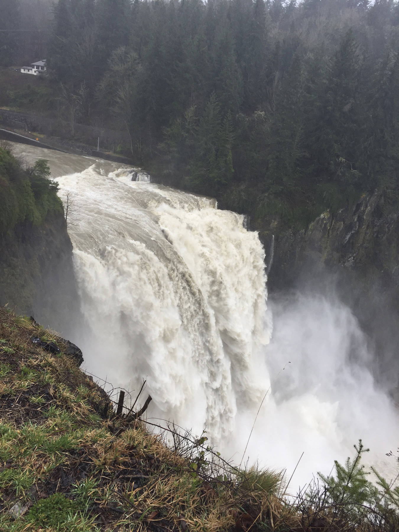
Dr. Mary Butwan, meteorologist with the National Weather Service, said areas of Puget Sound got up to six inches of rain between Dec. 18 and Dec. 20. But the heaviest rain fell south of the Snoqualmie River and didn’t make it into the basin.
At King County, Doug Williams, media relations coordinator for the Department of Natural Resources and Parks, said it can be hard to predict how severe a flood will be. Late last week, Floodzilla had predicted flood levels to reach around 57 feet along the Snoqualmie River near Carnation, but it steadily dropped until it dipped below the 54-foot flood level on Sunday.
The river avoided flooding last weekend, with the last severe flooding occurring in the Snoqualmie Valley in February 2020. On the week of Feb. 7, floodwaters rose above 56 feet near Carnation for the fifth time during the flood season. October 2019 also saw a major flood that came unusually early. It hit farmers the week before Halloween, which is usually an important week for sales.
In coverage from this past October, King County staff with the Office of Emergency Management were preparing for a season that could be similar to last year’s. Seasonal weather patterns were calling for a wet winter. But in October 2019, there had already been significant rainfall in the area that saturated the ground and primed the river system for flooding.
The winter 2020 weather prediction released by the National Oceanic and Atmospheric Administration shows that Puget Sound is likely to see a colder and wetter winter than normal. Much of the Southwest, South and East Coast will see hotter than normal temperatures. About 45% of the continental U.S. is experiencing drought.
This is in part due to an ongoing La Nina weather system.
“With La Nina well established and expected to persist through the upcoming 2020 winter season, we anticipate the typical, cooler, wetter North, and warmer, drier South, as the most likely outcome of winter weather that the U.S. will experience this year,” said Mike Halpert, deputy director of NOAA’s Climate Prediction Center, in a press release.
Moving into the Christmas weekend, no flooding was predicted along the Snoqualmie River, according to Floodzilla, as of press time Dec. 21.
The forecast called for a mild mid-week for North Bend with sun and clouds, and rain beginning toward the end. Temperatures were expected to drop below freezing on Tuesday night (Dec. 22), with temperatures in the mid-30s expected on Christmas Day.
Over Snoqualmie Pass, rain and sun were predicted through Thursday, with a snow expected beginning on Friday and continuing through the weekend. The Summit at Snoqualmie ski slopes are open despite the pandemic, with additional restrictions including required face coverings while in line and on the chair and in facility buildings.
