Landslide at Middle Fork Road presents ongoing danger
Published 1:30 am Wednesday, January 8, 2020
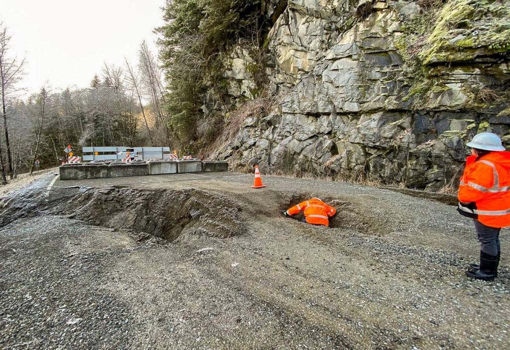
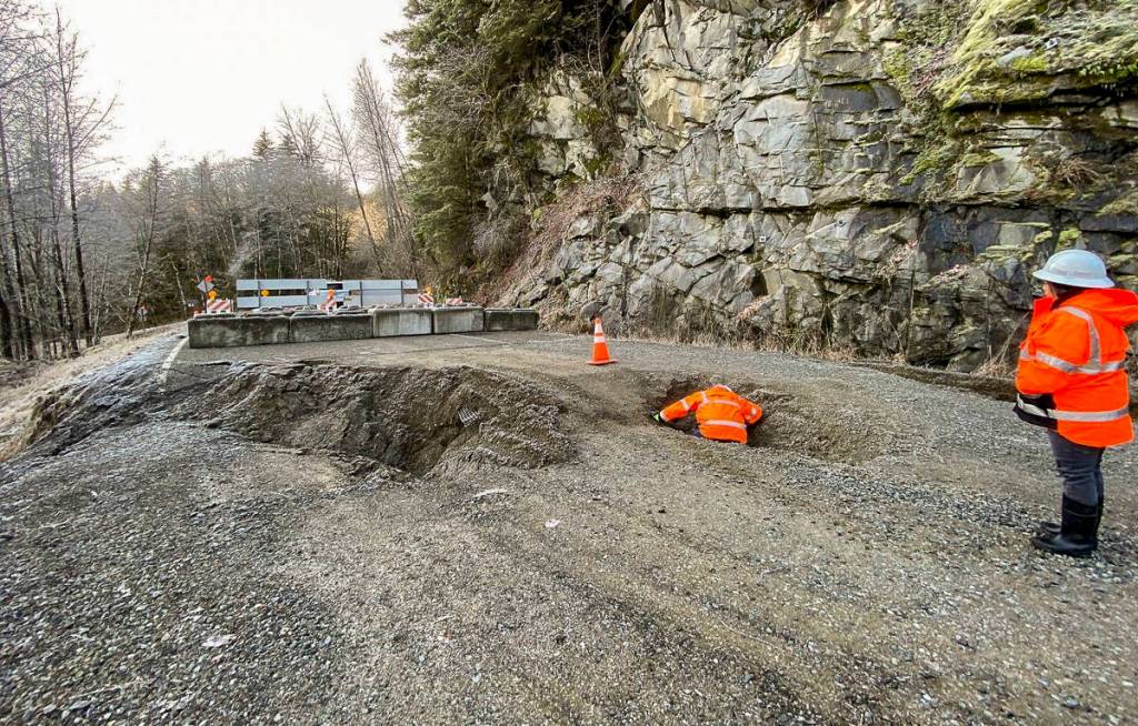


In an ongoing active landslide situation, Middle Fork Road, east of North Bend, is severely damaged and remains closed until further notice. The area is dangerous and crews will have to wait until dry weather, likely in spring, to complete a full assessment and create a repair plan.
For now, the road is barricaded, however people continue to circumvent the barricade, potentially at their own peril.
“People’s lives are in danger if they pass the barricade,” said Broch Bender, spokesperson for King County Road Services. “People need to heed the signs.”
Bender said the damage occurred at mile 9.6 on Dec. 20 after intense rainfall led to the landslide and the road washing out. The road was closed to all modes of traffic east of Mailbox Peak trailhead until further notice.
Bender said the road closure was to be extended half a mile west Tuesday, Jan. 7, after the Record’s press deadline, relocating the barricade to milepost 9 at the Oxbow Loop parking lot, as the entire area remains unsafe.
The situation remains dangerous and sections of the road are unpassable, practically destroyed. The area is an ongoing, active landslide and it is unsafe to cross the barricade by car, bike or even by foot, Bender stressed.
He said that despite clear signage and warnings, they have seen evidence — tracks — of hikers and bikers going around the original barricade to get to where they were going. But conditions are unsafe even for pedestrian traffic. The ground is still moving, the hillside along the road is unstable, and some surrounding trees are at a 45 degree angle.
“We’re doing all we can to get that safety message out,” Bender said.
The signs read, “danger,” “active slide zone,” and “no trespassing.”
It is a sole access road, popular among outdoor enthusiasts, that leads to several trailheads as well as a natural hot springs and campground. Unfortunately, there is no detour.
Right now, there is no timeline for when the stretch of road will reopen. That’s because at this point it remains too dangerous even for crews to be able to assess the damage fully and create a repair plan.
An initial assessment by crews sticking a rod in the mud measured the land to still be in motion on Dec. 30.
“We have evidence the land beneath the pavement is still moving,” Bender said.
He said crews won’t be able to complete an assessment and plan until the dryer months. The ongoing winter rainfall could make the situation and the damage worse.
Bender explained that the location is on an ancient landslide, still occurring, and its toe is at the river. So landslides in the area have been a chronic problem the county has had to face for decades, especially in winter, when groundwater levels are higher and rain water adds extra pressure.
This time, the stream above on the hillside jumped its bank, and torrents of water were flowing down the hill. Bender said that rush of water added to the recurring situation, overwhelming the soil under pressure from ground water and causing it to burst. Water was running both under and over the road, causing the sloughing.
Almost 7 inches of rain fell during a window of about 36 hours on Dec. 19 and 20.
The ancient slide stops in the summer months, Bender explained, when there is less rain and the ground water levels are also lower. When it dries out, there will be less chance of a slide and it will be more safe for the team to investigate.
The road was recently paved, completed in 2017. Now, there are several large sinkholes and sections where the pavement washed away. Ongoing winter rain storms could cause further damage to the road.
Bender recommended My Commute, a website, as a good resource to check on the status and closures of roads maintained by King County. The website is at kingcounty.gov/mycommute. Staff also posts updates on the King County local services Facebook page.