King County issues flood alert for Snoqualmie River
Published 10:50 am Thursday, October 28, 2021
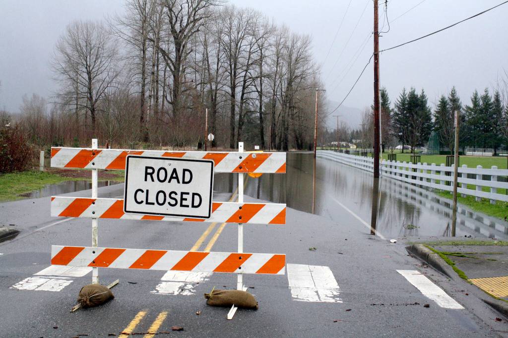
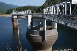
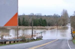
King County has issued a phase 2 flood alert for the Snoqualmie and Tolt River Thursday afternoon, with minor flooding expected in low-lying areas.
During a phase 2 alert, the sum of the Snoqualmie River’s three forks are flowing at a rate of over 12,000 cubic feet per second and several roads across the valley could be overrun with water. These roads include: Neal Road, SE Reinig Road, West Snoqualmie River Road NE, Snoqualmie Meadowbrook Road and Mill Pond Road.
Along the Tolt River, a phase 2 flood means the river is flowing at a rate of 3,500 cubic feet per second and the levee between the Snoqualmie Valley trail bridge and Highway 203, near 323rd Place SE, may see seepage.
“[It is] not expected to be a significant or long-lasting flood event for either river,” said Doug Williams, a spokesperson for the county Department of Natural Resources and Parks.
King County has also opened the county Flood Warning Center, an information hub for real-time time updates on flood condtions. To reach the warning center call 206-296-8200.
The National Weather Service issued a flood watch across most of western Washington Thursday morning. The flood watch began at noon Thursday and remains in effect through 5 a.m. Friday. Rivers in the North and Central Cascades and Olympic Peninsula are expected to reach near flooding stage, with a few possibly exceeding a minor flood stage in the afternoon. The Snoqualmie and Skykomish River are listed as two of the most impacted rivers.
Heavy rains, possibly between 1 and 2 inches, are expected in the Seattle area after 11 a.m and into the night. Heavy rain also bring the possibility of landslides across the region.
The National Weather is encouraging residents to watch for flood warnings and be prepared to take action should flooding develop. This story will be updated if information changes.
Editor’s Note: This story has been updated to reflect the King County phase 2 alert.