
Updated: Jan. 22, 2018 at 11:25 a.m.
After a recent discovery of possible landslide danger to one of Snoqualmie’s water sources, the Snoqualmie City Council voted Jan. 8 to declare the situation an emergency, in order to quickly select the engineers to develop recommendations for methods to address the danger.
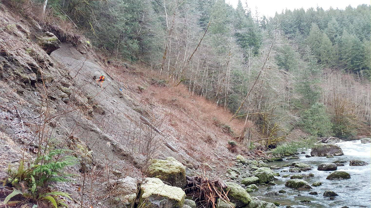
The city of Snoqualmie uses a spring box water collection facility, Canyon Springs, along the North Fork of the Snoqualmie River as a source of more than 1,500 acre-feet of water per year. Community Development Director Mark Hofman told the Record last week that when public works employees were checking out the area just before Christmas, they discovered evidence of a recent landslide.
The landslide, which was determined to have happened in November, was about 150 feet across and 90 feet in height on the hillside. Loose soil fell into the river and was washed away. At the site, two pieces of old pipe were exposed on the face of the hill with the newer replacement pipe only about six feet away from the top of the slide.
The danger to the city lies in the possibility of a bigger landslide, cutting off the river entirely and breaking pipes used to collect water, putting an important part of the city’s water supply at risk. According to a city analysis, the slide has shifted the pipe alignment in a way that it could break if any other land movement happens.
Jeff Hamlin, Snoqualmie project engineer, raised other considerations about the Canyon Springs area in his presentation for the council, including the trail access to the area which supports foot traffic and improvements needed for vehicle access. He also noted that long-term solutions may require upgrades and improvements to be made to the spring collection.
The initial findings detailed in Hamlin’s presentation state that “failure is imminent within a couple of years” and because future slides and slope movement will occur, stabilization methods should be used while the city pursues a long-term solution.
The emergency declaration allowed the city to hire contractors to address the problem without going through the lengthy process of advertising for bids. The city selected Aspect Consulting and RH2 Engineering to go out to the site to research the area and come back with recommended actions.
The city’s current water pipe is “endangered, but it’s not exposed,” Hofman said, adding that the council’s action was to approve research into the problem, not design a solution.
“They wanted to embark on some research, get Aspect Consulting on board to come out and investigate what any sort of temporary fixes would be, so we wouldn’t wait until that pipe is exposed or broken,” Hofman said. “The request to the council was not give us to design (but to) get some experts out there and gauge where we are at.”
The city contracted Aspect Consulting for site reconnaissance, geologic review, preliminary geotechnical evaluations and follow up reports for a maximum cost of $20,000. RH2 Engineering was chosen to research and develop recommendations for actions to address the short-term dangers of the area, as well as a comprehensives plan for a long-term solution. The cost of their work is also not to exceed $20,000.
Hofman said the city wants to be as proactive as possible in order to avoid a situation in which Snoqualmie citizens turn on the tap, but no water comes out.
In a Jan. 16 press release, the city indicated there was no danger to private property, homes, or residents in the area. In addition to Canyon Springs, the city has two other water sources at North Wellfield near Tokul Road and South Wellfield close to downtown Snoqualmie. If the Canyon Spring line fails, those water sources will face a heavier burden and water conservation measures may become necessary.
The resolution was passed in a six to one vote with Councilmember Peggy Shepard voting against. Shepard said she voted against the resolution because she had requested to go to the site herself, but did not receive a response from city staff. She said she would have preferred to see the site in person before voting.
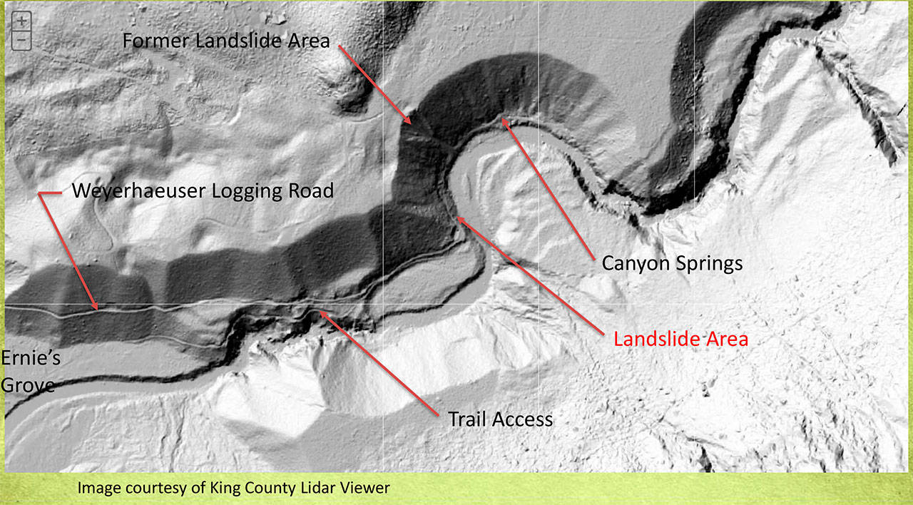
A map of the Canyon Springs area marking the location of the recent landslide. (Courtesy Photo)
